|
Early Story about the Greenway ProjectThe City of Derby has moved from dream to completion of the Greenway that will ring the downtown area of Derby from the Derby/Shelton Bridge on the Housatonic River to the Division Street Bridge on the Naugatuck River. It is quite fitting that the city undertook construction of this project just as it remembered the 50th anniversary of the 1955 floods which devastated the area and turned both rivers into wild streams that provided unbelievable destruction along their paths. The exciting plan promises to provide the public with a whole new appreciation for the rivers that have been such an important part of the city's rich history. Where the two rivers were once the focal point for transportation and industry (and even natural disaster!!), they will now be part of a new chapter where their scenic beauty and recreational potential will enhance the quality of life in the community and frame a revitalized downtown.
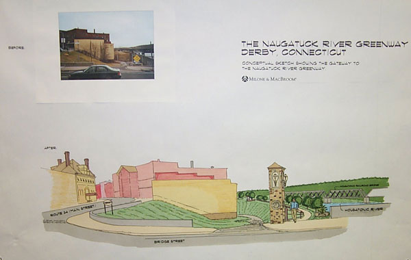
The picture to the left shows one of the proposed gateways to the trail at the corner of Main Street next to the Derby/Shelton Bridge. Walkers, runners, in-line skaters and bicyclists will share a 10 foot wide path along the top of the dike running southeast along the Housatonic River. The trail will then leave the dike and wind down to the boat launch area under the Commodore Hull (Rt. 8) Bridge. A public parking area and upgraded boat launch will serve as another public gateway to the trail.
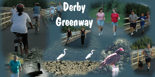
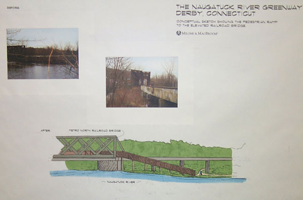
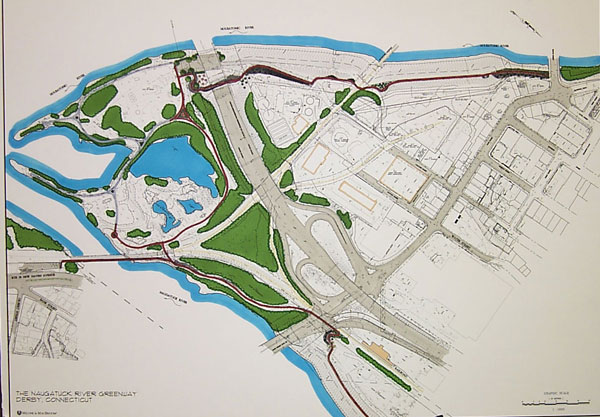
All told, the paved area of the Derby Greenway will be approximately 2 miles with another 1/2 mile of unpaved trail running in the O'Sullivan Island area. The Greenway will also pass next to all six of the bridges and railroad trestles that span the two rivers. Information from construction phase of the GreenwayThough it is not officially open, the Derby Greenway has become a major success as hundreds of visitors have been flocking to it on a daily basis since early summer for exercise and serenity. With the footbridge over the rail trestle to Shelton now in place, the bulk of the construction is now complete and the 1.7 mile trail is now an unbroken ribbon framing the old Borough of Birmingham in the center of Connecticut's smallest city. The trail runs from the corner of Main & Bridge Street in the downtown area to Division Street. The paving of the footbridge is not slated for completion until spring, 2006. However, the rest of the trail is being used extensively.
Map showing the Greenway (red) ringing the old Borough of Birmingham! Click on pictures for larger images! Click here for a satellite picture and map showing elevations on the trail
Little did they realize that long before the project is completed, it is already a major hit with hundreds of people traversing the mostly completed portions along the Naugatuck River and O'Sullivan's Island. Much work remains to be done especially on the Housatonic River. A ramp and main entrance at the corner of Main and Bridge Street are still under construction as well. Signage still remains to be completed as well. |